
3D Surveying and Mapping Technologies: How We Draw Your Project’s Reality with Ultimate Precision
Discover how 3D surveying and mapping technologies are completely transforming the way you work in engineering. From highly accurate realistic site models to quantity calculations and detailed planning, this technology has become an essential element for any successful project. This article will take you on a simple, practical tour inside the world of 3D surveying, where you will see firsthand the difference it can make in your time, cost, and work quality.
5/26/2025

Imagine standing on an empty plot of land… surrounded by dirt, some excavation marks, and a few piles here and there. To your eyes, it’s just land. But for a skilled surveyor, especially one using 3D surveying technologies, that land instantly transforms into a smart map, full of information, dimensions, and layers… a map you can build your dreams on with precision, without missing a single detail.
The story begins as soon as we arrive at the site. In the past, we measured every point manually and drew every line on paper or AutoCAD. Now? Everything has changed 180 degrees. Using modern devices like LiDAR laser scanners or drone photogrammetry, we can capture millions of points from the site in record time and create a 3D model of the place, including every detail: elevations, slopes, landmarks, and the site’s true dimensions.
What makes these technologies exceptional isn’t just speed but also the ultra-high accuracy reaching less than one centimeter, along with the large data volume that translates the project from a mere idea into a comprehensive digital model. And this model isn’t just for viewing! It can be:
Analyzed with software like Civil 3D and Revit
Converted into execution maps and BIM plans
Integrated with quantity takeoffs and budgets
Presented interactively to clients or consultants
At GeoDola, 3D surveying isn’t just an “extra service,” it’s a fundamental part of our work. We rely on it for infrastructure projects, land development, urban design, and as-built documentation for large projects. The client benefits twice: once because they see their project before a single brick is laid, and again because they can plan and act based on 100% accurate real data.
Here’s a real example: we worked on a project in a mountainous area, requiring detailed surveying of the entire site with challenging terrain variations. Using 3D and drone survey technologies, we completed the survey in two days instead of two weeks, delivering a full digital model that included every slope and cavity. This helped engineers select the best construction locations and saved both time and money.
When it comes to 3D as-built surveys, the real value of the technology shines. You can compare what was actually built against the original plans and easily detect any discrepancies, which is crucial during handover and quality control.
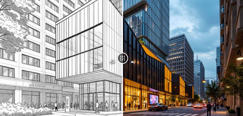
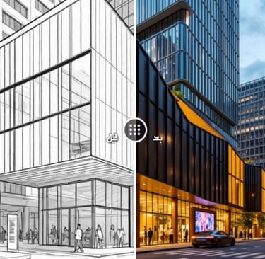
Another great advantage is that 3D surveying helps prepare realistic visual presentations for clients and investors. Instead of showing a boring 2D map, you can offer a “virtual tour” of the site or project while it is still in the planning phase. This greatly influences funding and approval decisions.
So, whether you have a new project, work at a design firm, or are a student wanting to understand the field, you must know that 3D surveying technologies are leading the engineering market today. They are not a luxury—they are a necessity. This is exactly what we offer at GeoDola with expertise, professionalism, and the latest tools that keep your work always one step ahead.
GeoDola | Surveying & Geomatics Solutions
All rights reserved © 2026