Our Comprehensive Training Programs
Professionalism is not by chance, it’s a choice
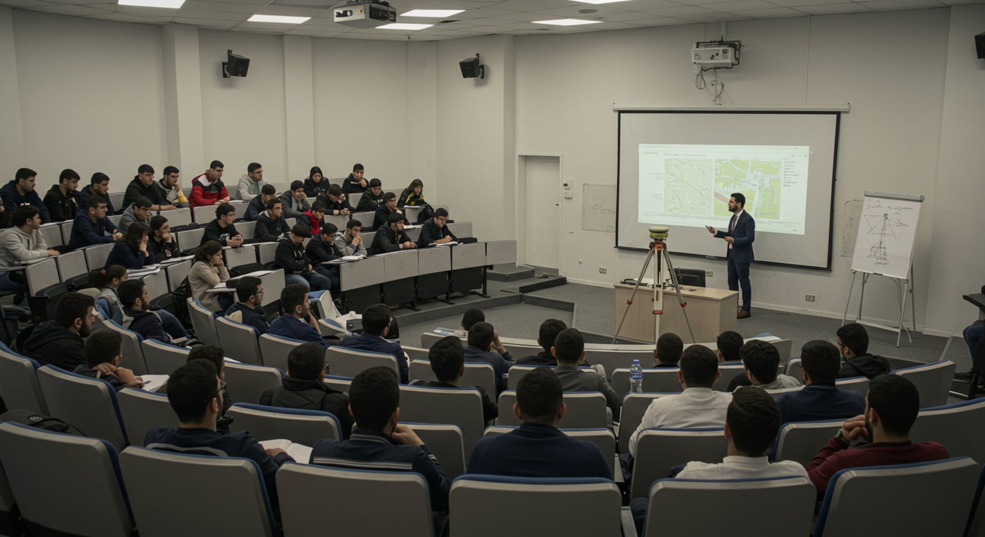
At GeoDola, we don’t offer traditional courses; we deliver smart, intensive training paths built from real field experience. Every hour of our training is packed with practical knowledge distilled from real challenges we’ve faced on site,presented in the simplest, most effective way.
GeoDola courses focus on deep understanding, hands-on application, and overcoming daily work obstacles. We bridge software with fieldwork, GIS with reality, and analysis with decision-making. This isn’t just a promise,it’s the result of over 750 hours of training designed to meet the real needs of the surveying and engineering market.
Training is available:
✅ Offline at MSI Academy, certified by MSI.
✅Online, with high-quality, regularly updated content, the same level of support, and competitive pricing for serious engineers.
Your time is too valuable to waste on superficial experiences. If you want to build real confidence, enter the market with clear vision, solid skills, and a CV that speaks for you—this is the place for you.
We don’t just teach you to pass; we train you to excel. This is more than a certificate—it’s a career and mindset upgrade.
Opportunities don’t wait, and excellence has a path. Don’t settle for being “good”… be the best.
Register now and start building a stronger version of yourself.

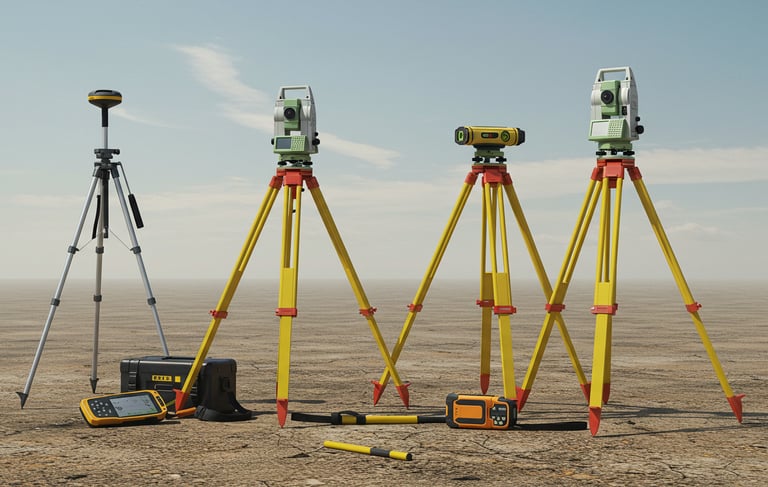
The Complete Survey Instruments Mastery Course
This course covers GPS Station, GPS Navigator, Total Station, Auto Level, Laser Level, and Laser Distance Meter.
Designed for surveyors who want to master their tools with confidence, the course takes you from basic awareness to proficient operation. You’ll learn to use each device accurately—from precise GPS positioning, team guidance, Total Station surveying, to leveling with Auto and Laser Levels, and measuring distances smartly with the Laser Distance Meter.
Beyond handling equipment, you’ll grasp the logic behind procedures and learn how to solve real field challenges, ensuring you work efficiently and error-free. If you aim to stand out in the surveying market and be ready for any site task, this course is for you.
Mastering Survey Engineering Software
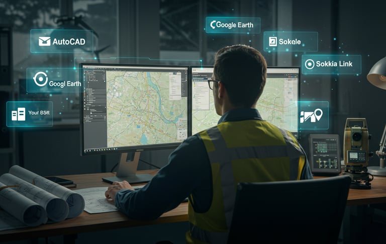
This course equips engineers and surveyors to become market leaders by mastering essential digital tools alongside their field equipment. You’ll gain advanced skills in AutoCAD for precise drafting, Civil 3D for complete project execution, and use Google Earth and ExpertGPS for site analysis and data export. The training also covers professional data transfer with Sokkia Link and powerful data management and analysis using Microsoft Excel.
More than just software tutorials, this course offers practical, real-world projects and examples that teach you how to apply each program effectively and strategically. It transforms you from a field operator into a skilled engineer capable of designing, managing, and analyzing projects with confidence and distinction.

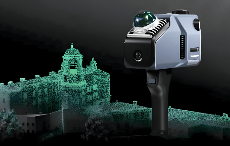
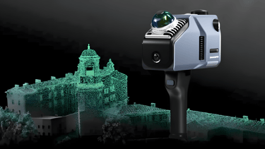
3D Surveying with 3DMakerpro Eagle LiDAR Scanner
This course introduces the latest breakthrough in surveying technology: the 3DMakerpro Eagle LiDAR scanner, featuring LiDAR, AI stabilization, and dual-camera mapping for ultra-fast, highly accurate, and low-effort 3D data capture. It’s a game-changer that transforms traditional surveying by producing precise millimeter-level 3D models of real-world sites.
You’ll learn everything from device setup and operation to data processing and creating detailed maps and models. The course highlights how this technology can reduce project time by over 60%, enabling you to deliver impressive reports and visuals that set you apart from traditional surveyors. This training is not just a skill upgrade—it’s a career leap into the future of surveying.
3D Survey Data Processing and Analysis
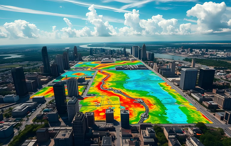
This course takes you beyond data capture with the 3DMakerpro Eagle LiDAR Scanner, teaching you how to process and convert point cloud data into precise, engineering-ready 3D models. You’ll master specialized software like 3DReshaper, CloudCompare, Leica Cyclone, and Autodesk ReCap—from importing and cleaning data to creating and analyzing digital terrain (DTM, DSM) models with high accuracy.
Additionally, you’ll learn to prepare these digital models for integration with 3D design platforms like 3ds Max and Revit, enabling seamless fusion with architectural and engineering projects. This course equips you to deliver comprehensive surveying solutions, combining data accuracy with advanced modeling skills, opening new opportunities in the engineering market.


Coordinate Systems, Transformations, and GIS Integration
This course provides a clear understanding of different coordinate systems and how to accurately convert between them—an essential skill to avoid costly field errors and ensure reliable data throughout a project. You’ll also learn how to efficiently integrate surveying data across engineering software like AutoCAD and Civil 3D with GIS and Remote Sensing applications, enabling smooth data transfer and advanced spatial data management. This knowledge will improve the quality of your work and open new opportunities in the surveying and engineering fields.

Field Engineer’s Golden Skills Development Course – Professional Essentials for Career Success
This course is designed to equip field engineers with the core personal skills needed to excel in today’s job market. You’ll learn how to craft a standout CV, prepare confidently for interviews, and kick off your first site project with smart project management and team coordination.
Beyond that, the course focuses on leadership, effective communication, time management, and task organization — empowering you to deliver projects on time and lead your team with confidence. It's not just about skill-building; it's a transformative step toward becoming a highly competent, trusted, and future-ready field engineer.


GeoDola | Surveying & Geomatics Solutions
All rights reserved © 2026