Discover GeoDola’s Story
After years of research, I developed a unique approach combining precision, curiosity, and passion.
GeoDola is more than surveying—it’s the vision of an engineer who loves Earth and explores space.
Knowledge is a bridge between people, technology, and ambition.


+1153
+25K
Social media followers
Satisfied clients
And my Journey from Surveying to Space

Professional Summary
GIS and surveying expert with 15+ years leading 2D/3D topographic projects using advanced LiDAR and GNSS technologies in Egypt and Saudi Arabia. Experienced in team leadership and cutting-edge methods to deliver precise, efficient results for large developments. Certified trainer with 750+ hours, focused on innovation, knowledge sharing, technical reporting, data analysis, and effective collaboration to ensure top quality and safety.
Academic Background | 2007 – Present
Began with a solid foundation in geography and surveying at Fayoum University, later expanding into a Master’s in Astronomical Geography (Cosmology) to deepen my scientific and technical understanding. I also pursued Islamic Studies and Sharia, combining geographic sciences with cultural depth for a well-rounded academic perspective.
Training Courses | 2009–Present
Completed specialized training on surveying instruments including Total Station, Level, GPS, and Theodolite, along with software such as AutoCAD, Civil 3D, Surfer, Land Desktop, Prolink, and ArcGIS—enhancing my precision and spatial data analysis skills. Proficient in Microsoft Office and advanced online research. I also studied marketing, 2D/3D design, and social media management, adding creative and strategic depth to my skill set. All courses were completed with distinction, reflecting my strong commitment to continuous professional growth.
At Dar for Trading and Construction (Detac), I led complex surveying projects including Oriana 4 by Al-Futtaim (85 villas with full infrastructure), the high-spec Arc office building in Smart Village, and several Etisalat Misr buildings involving drainage, finishing, and landscaping across 3 feddans. I also managed surveying works for Royal City (47 villas) and the multi-story Administrative Prosecution building in 6th of October City—showcasing my ability to deliver residential and administrative developments with precision and professionalism.
Experience in Egypt | 2011–2015
Experience in Saudi Arabia | 2015–2019
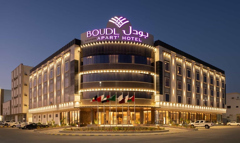
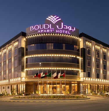
At Boudl Hotels & Resorts in Riyadh, I led the Surveying and Mapping Department, overseeing high-end hospitality and residential projects. I managed surveying and planning for Narcissus Resort in Jeddah (60 villas, admin buildings, recreational facilities, and a 150 m extension into the Red Sea, including roads, drainage, and landscaping). I also supervised surveying for Braira Hotel in Dammam (multi-story buildings, service areas, pools, and landscape work). Additionally, I provided consultancy for major Riyadh projects like Narcissus Al Khuzama Hotel (13 floors and 4 basements) and Thumamah Villas (luxury villas with pools). I also handled the survey design and execution for Narcissus Classic Tower and Boudl-Nakheel Resort in Unaizah. These experiences reflect my advanced skills in delivering complex hospitality and residential projects with precision, coordination, and adherence to quality and timelines.
Training Academy | 2014–Present
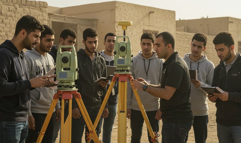
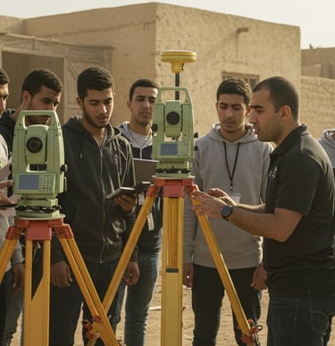
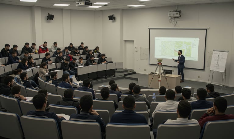
I deliver advanced, hands-on training programs across top Egyptian universities, with a track record exceeding 750 specialized training hours. The courses cover practical use of modern surveying tools such as GPS systems and 3D LiDAR scanners, along with applied training on a wide range of 2D and 3D engineering software. My training approach integrates theory with real-world application, ensuring participants are well-equipped to implement the latest geospatial and engineering technologies. This professional development plays a key role in enhancing the skills of technical and engineering teams, enabling them to handle complex project challenges with confidence and precision.


GeoDola embodies the vision of a bold surveying dream brought to life—built on over 15 years of deep expertise in geospatial and surveying solutions. The company combines engineering precision with scientific depth, leveraging cutting-edge technologies like 3D LiDAR scanning, GNSS/GPS systems, and advanced design software to deliver exceptional accuracy and efficiency across a wide range of projects including hotels, residential units, and office buildings.
At GeoDola, surveying is more than just measurement—it’s a science mastered, a passion lived, and a lasting impact etched into every project we touch.
GeoDola | Surveying & Geomatics Solutions
GeoDola | Surveying & Geomatics Solutions
All rights reserved © 2026